

HSH maps and graphs is an ongoing index of interactive maps, graphs and transparency records related to San Francisco HSH supportive housing, shelters, DPH sites, public-safety calls and related datasets.
Newest work is listed first within each topic. Older versions are retained where they document the development of a map or dataset.
Start here
|
Trauma Informed San Francisco – a chronology
10.6.26 Trauma informed San Francisco, a chronology. |
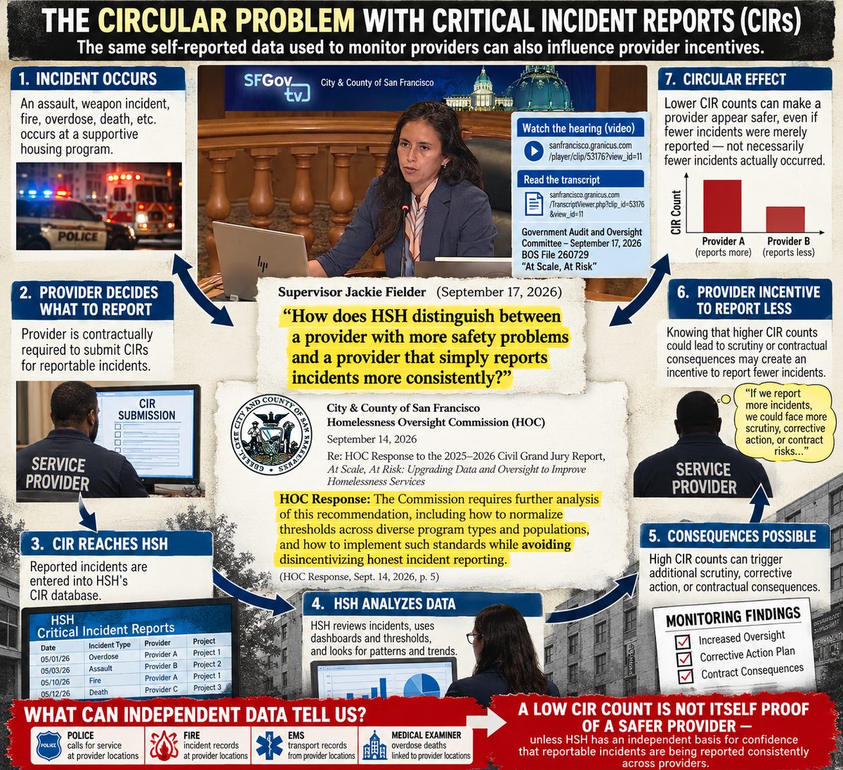
| HSH critical incident reports chronology 2018-2016
10.6.26 HSH critical incident chronology 2018-2026 alternate link https://www.bluoz.com/hsh-cir.html
|
|
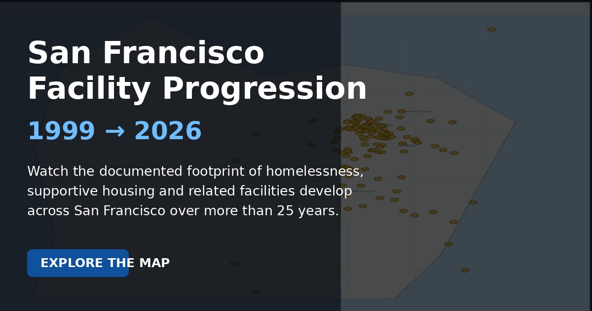
10.3.26 animated HSH non profit expansion map 1999-2026
|
|
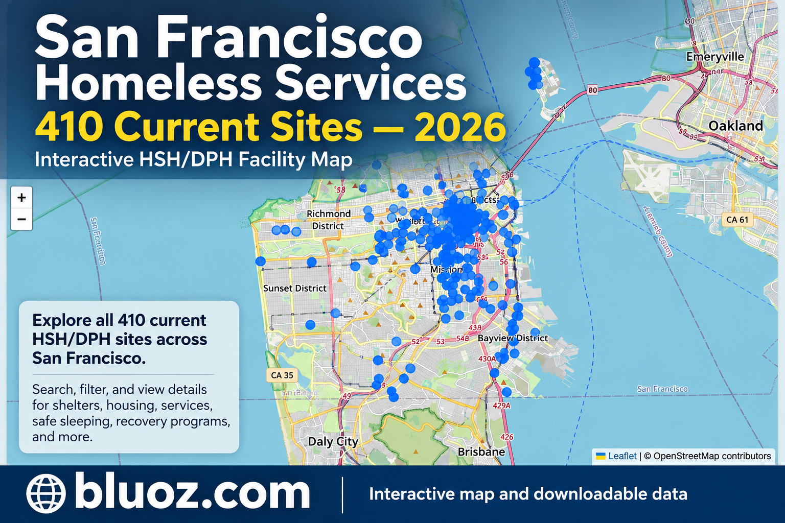
10.2.26 updated map of all currently active DHP/HSH sites in the 2026 portfolio
|
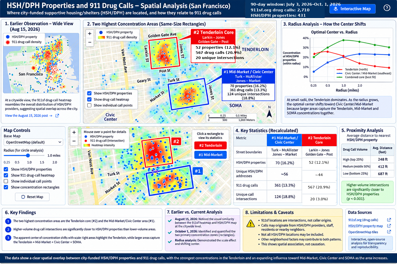
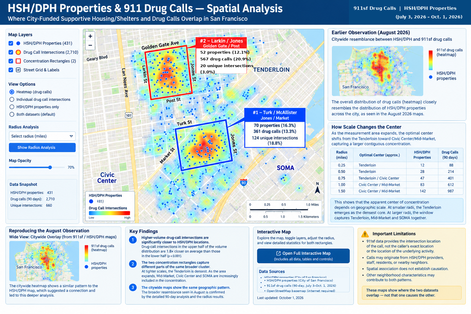
| New map 10.1.26
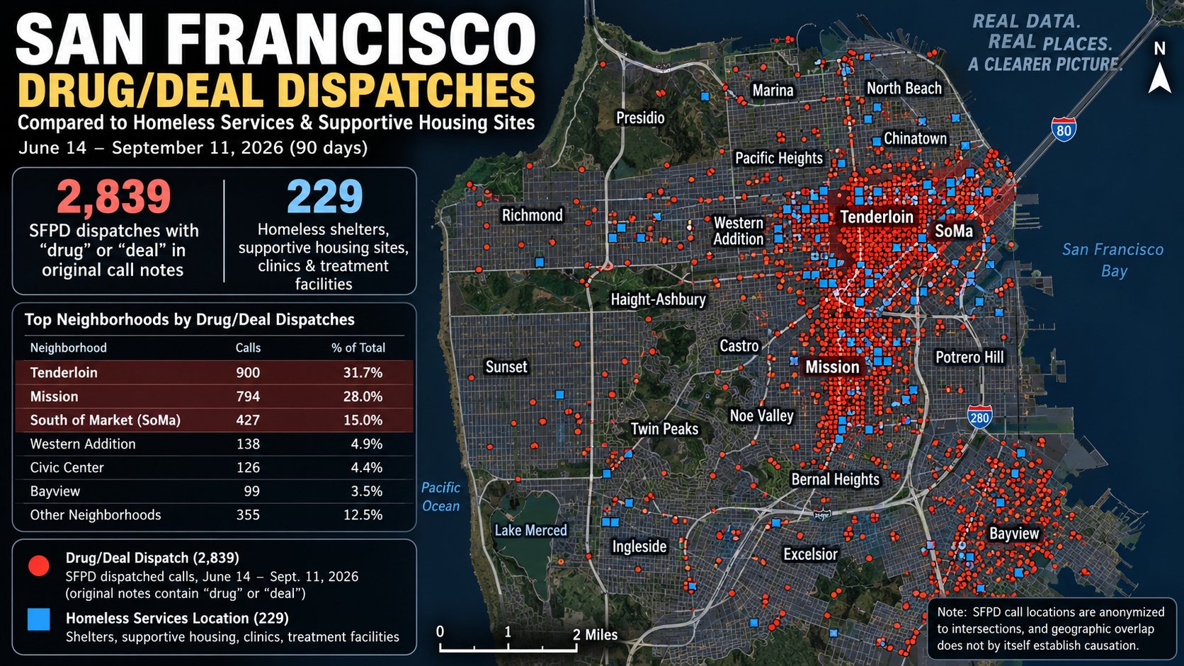
10.1.26 new map comparing last 90 days drug calls with known HSH/DPH properties
|
| 391 Ellis visual audit
9.30.26 January–August 2026 visual audit of SFPD arrest records listing 391 Ellis, including handwriting review, source scans and monthly trends. |
| Current master map
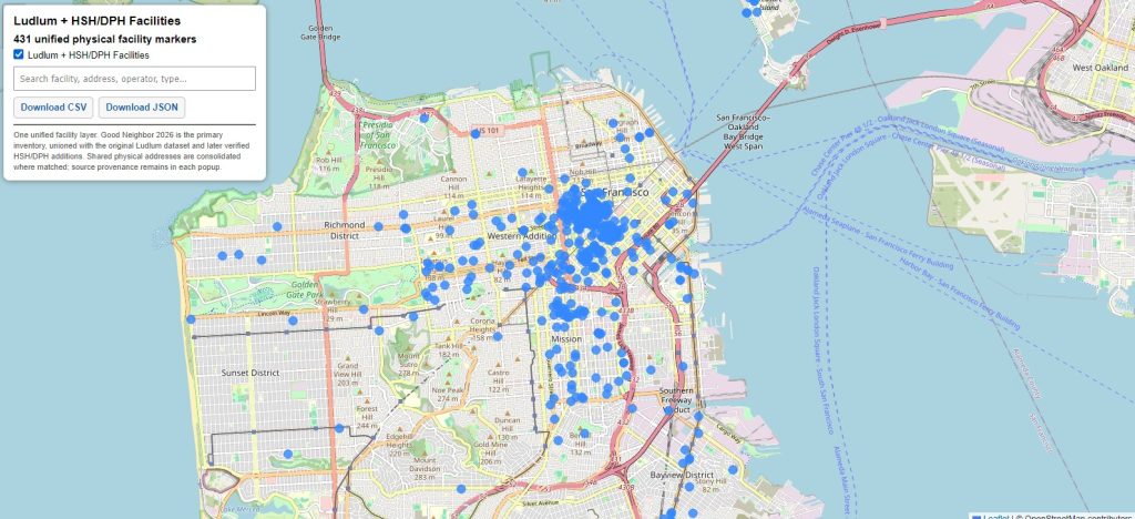
9.27.26 431 HSH/DPH facilities in one unified layer with downloadable data. |
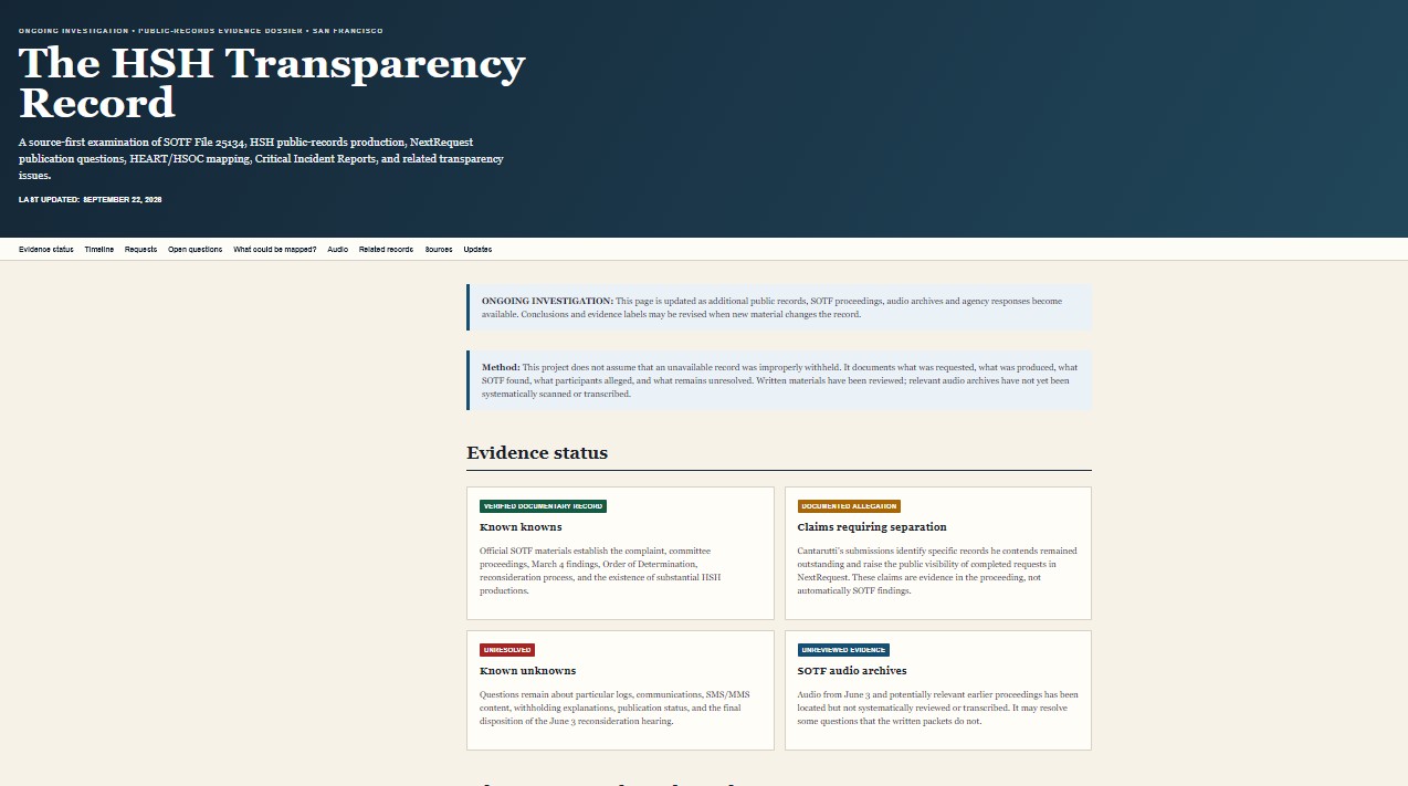
| HSH transparency investigations
9.22.26 Ongoing HSH transparency investigations. |
| DPH transparency record
9.23.26 Dedicated DPH transparency record. |
Browse by topic
Latest / master maps Police & drug-incident analysis Street teams / CAD / 311 / RESET HSH / DPH facilities & harm reduction Transparency records EMS / fire / calls near HSH sites
Latest / master maps
| 391 Ellis visual audit
9.30.26 January–August 2026 visual audit of SFPD arrest records listing 391 Ellis, including handwriting review, source scans and monthly trends. |
|
Unified HSH / DPH master map 9.27.26 Master map expanded from 240 to 431 HSH/DPH facilities in one layer, with downloadable data. |
|
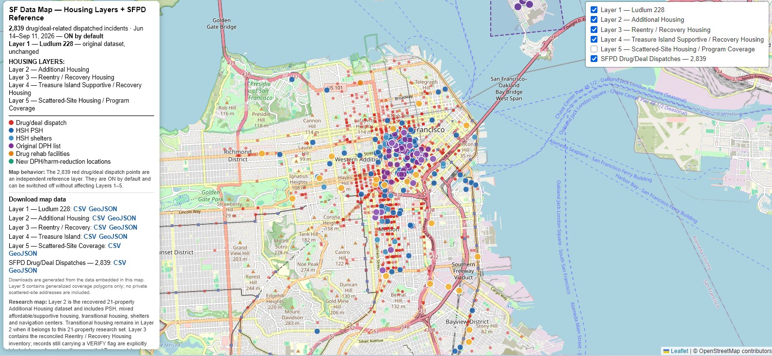
Six-layer master map V4 9.17.26 Nearly finalized six-layer version. |
|
Six-toggle master map 9.16.26 Nearly finalized version with downloadable data links. |
Police & drug-incident analysis
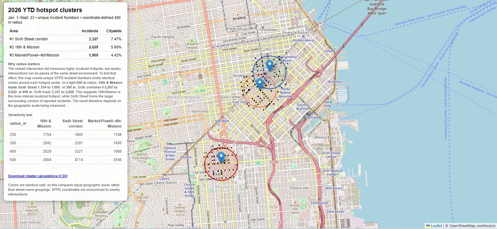
| Revised top-three incident clusters
9.25.26 Revised hotspot map with added explanation that the 4th & Market / Powell / Union Square area is mostly retail theft. |
|
2026 hotspot cluster map 9.25.26 2026 highest-crime hotspots with reference to 2010 hotspots and a cluster-radius comparison. |
|
2026 highest incident locations 9.25.26 Map of the highest incident locations in 2026 YTD. |
|
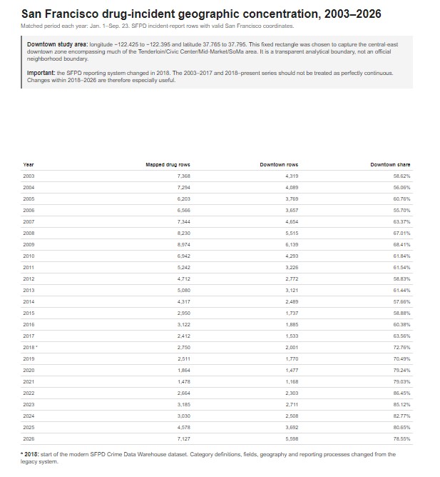
Drug-incident geographic concentration, 2003–2026 9.23.26 San Francisco drug-incident geographic concentration analysis. |
| Drug incident progression map, 2003–2026
9.23.26 Accompanying map showing drug-incident progression with chart. |
|
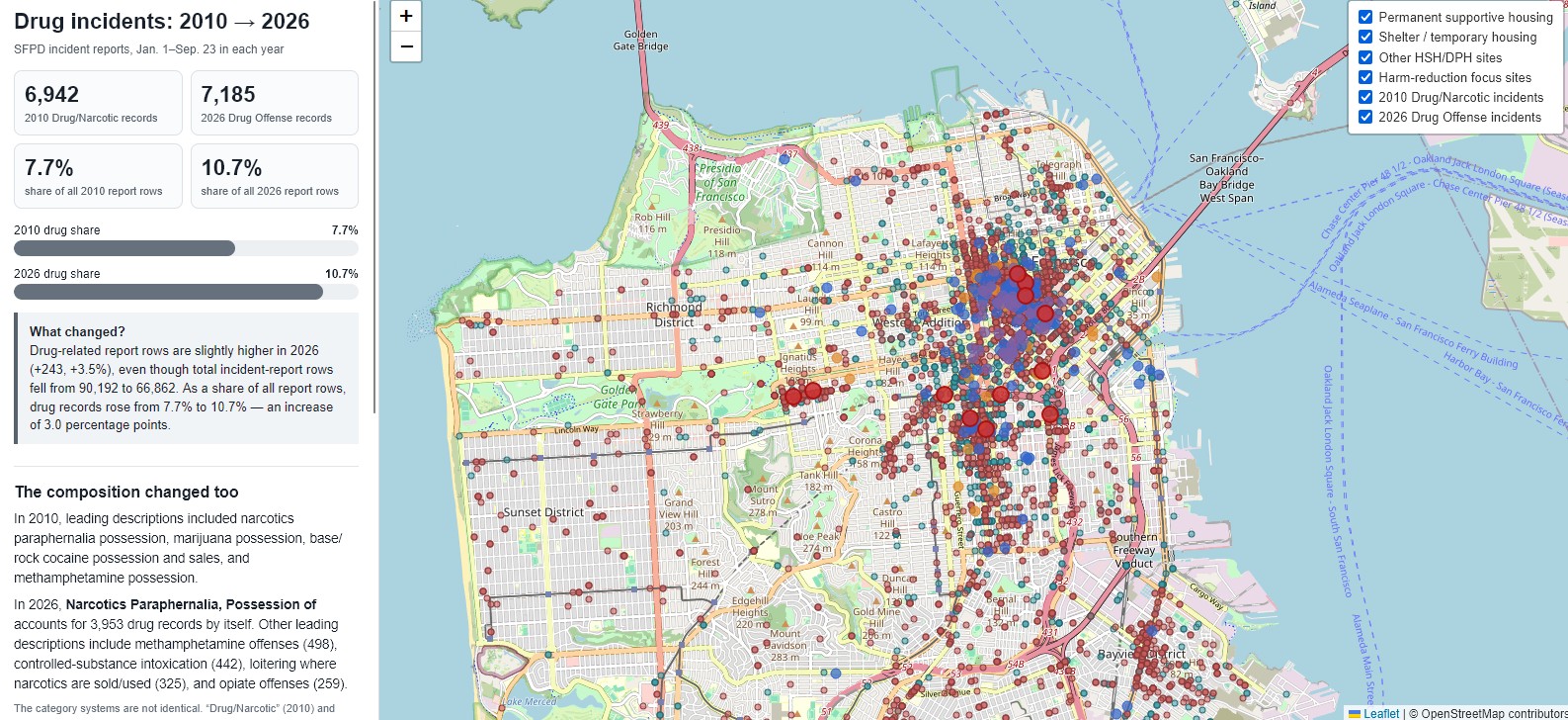
2010 vs. 2026 drug incidents 9.23.26 Police incident report comparison showing where drug incidents occurred in 2010 and 2026. |

Street teams / CAD / 311 / RESET
|
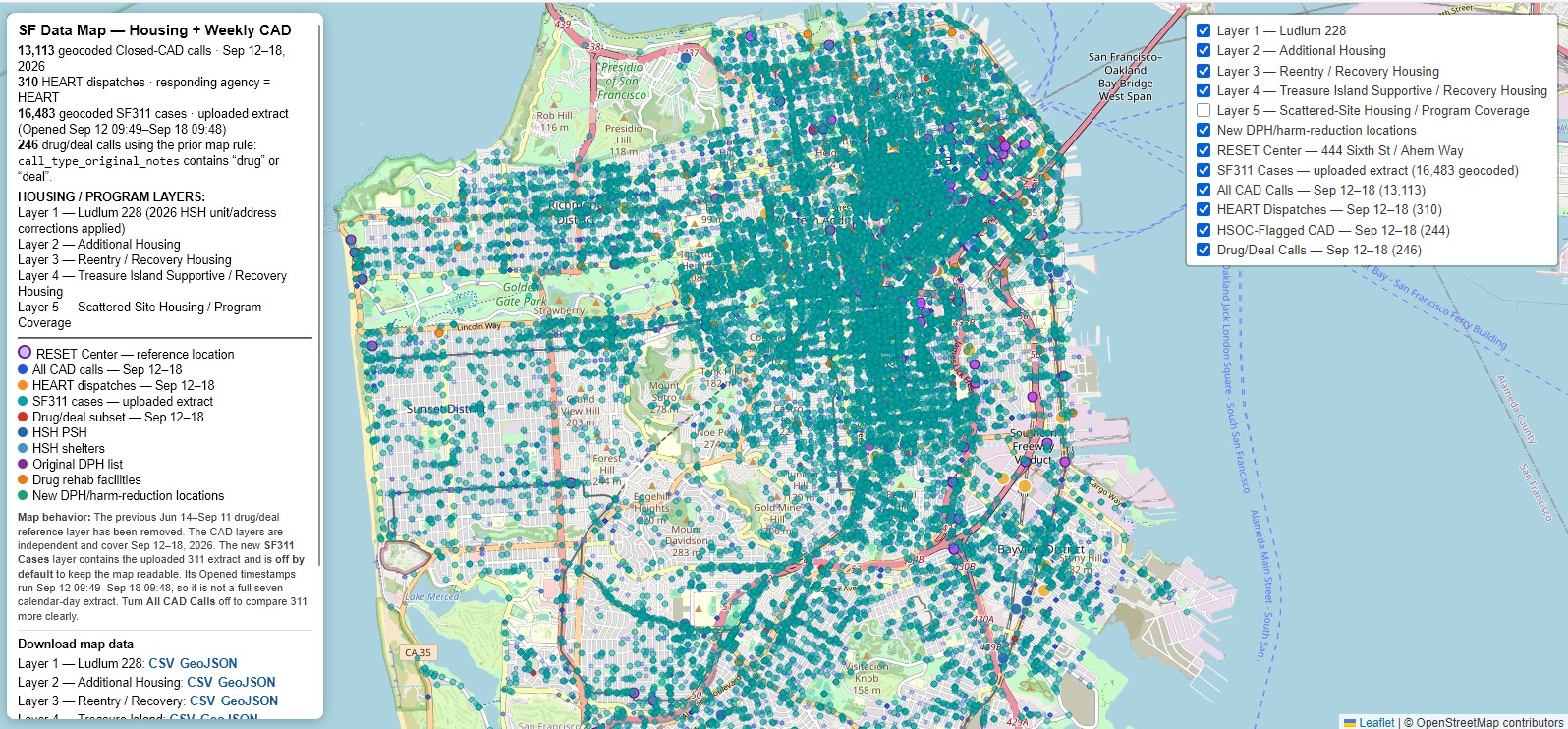
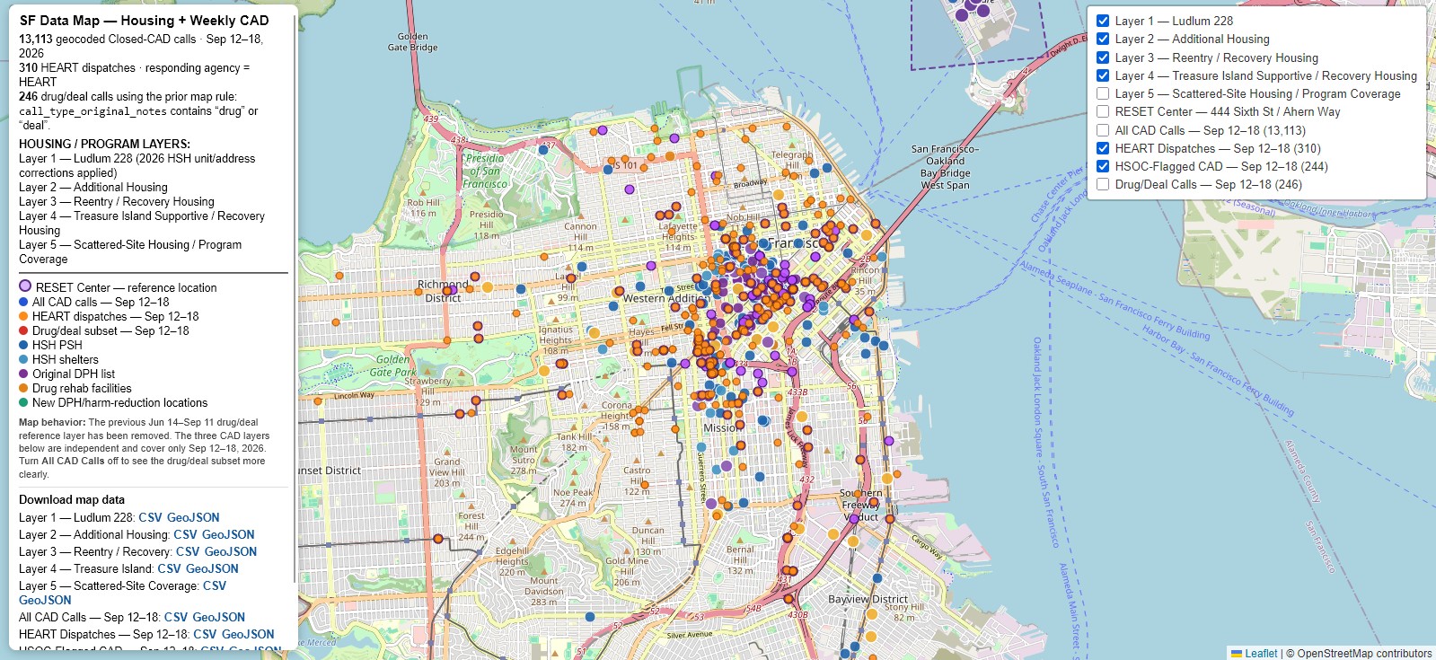
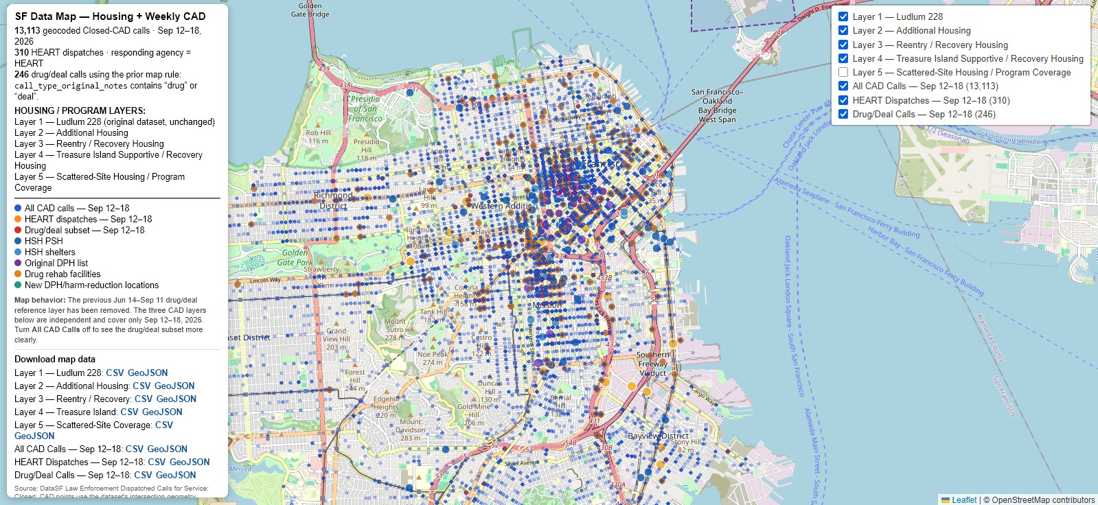
Weekly CAD / HEART / HSOC / 311 / RESET 9.23.26 311 layer added for the week of September 12–18, 2026. |
|
HSOC and HEART street teams 9.21.26 Map distinguishing HSOC and HEART street teams. |
| Corrected housing layer
9.21.26 Minor corrections including the Graystone at 66 Geary and other misplaced sites. |
| RESET Center at 444 6th
9.21.26 RESET Center added at 444 6th Street. |
|
Weekly CAD with HEART 9.20.26 Three-layer map with original housing layer, all CAD calls, and HEART/street-team/drug-related calls. |
HSH / DPH facilities & harm reduction
|
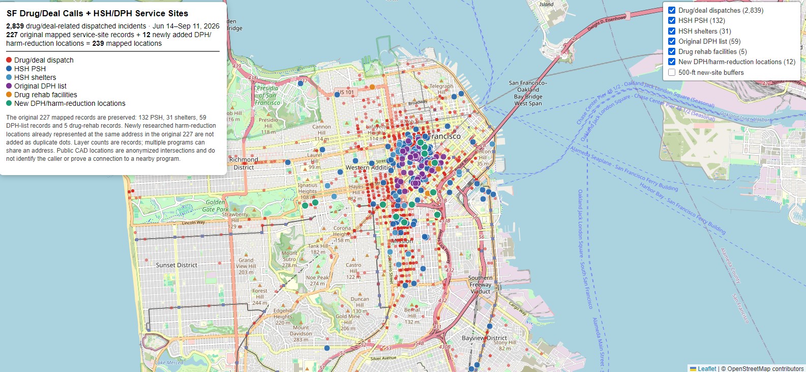
228 HSH / DPH / harm-reduction sites 9.15.26 Updated to 228 sites, including the Caldrake, with call counts. |
| 227-site HSH / DPH / harm-reduction map
9.15.26 Earlier 227-site version. |
| 227-site map with call counts
9.15.26 Earlier 227-site version upgraded with call counts. |
Transparency records
|
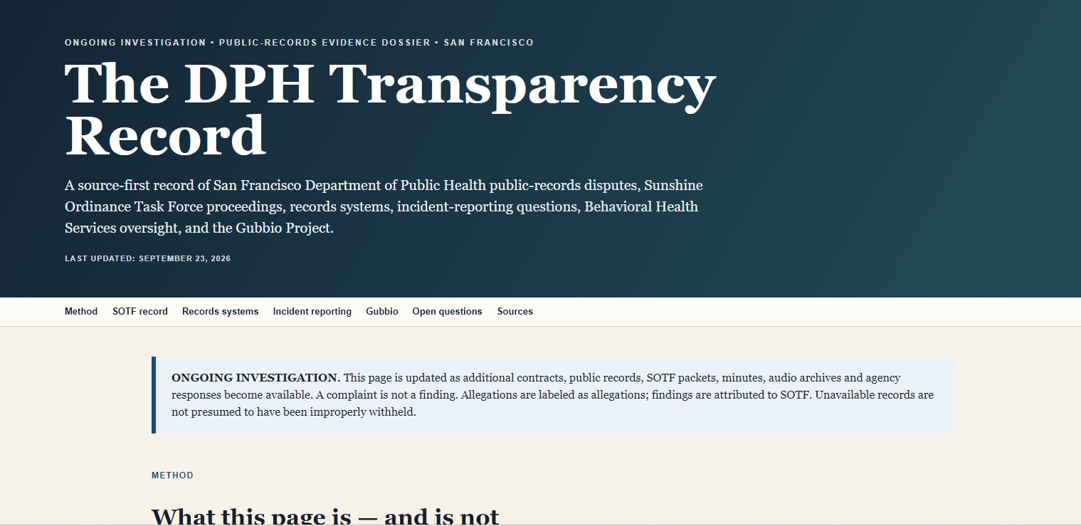
DPH transparency record 9.23.26 Dedicated DPH transparency record, tracked separately from HSH. |
|
HSH transparency investigations 9.22.26 Dedicated page for ongoing HSH transparency investigations. |
EMS / fire / calls near HSH sites
|
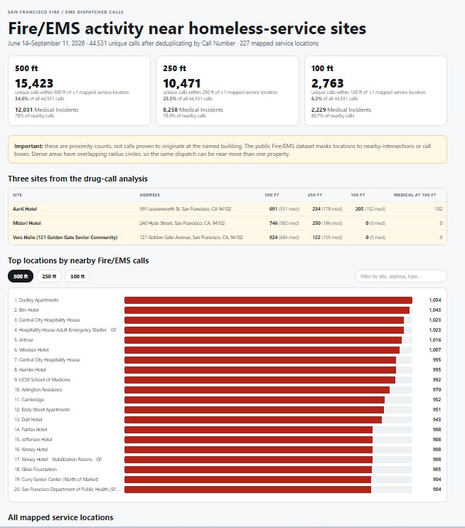
Fire & EMS dispatches near HSH sites 9.14.26 EMS and fire dispatches from June 14 through September 14, 2026. |
|
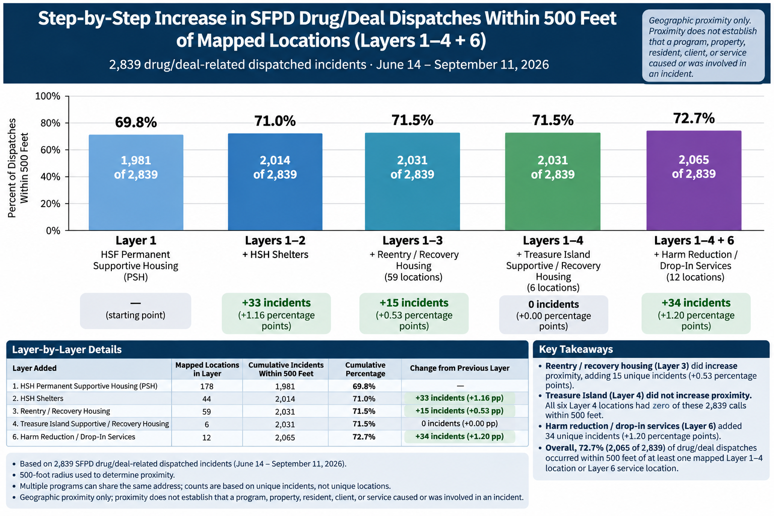
Drug-related calls within 500 ft of HSH sites 9.14.26 Drug-related calls within 500 feet of an HSH site, June 14 through September 14, 2026. |
About this index: Older versions are retained where they document the development of a map or dataset. Newer entries generally supersede earlier versions unless otherwise noted.